Why General Contractors and Developers Are Using Weekly Drone Mapping on Construction Sites
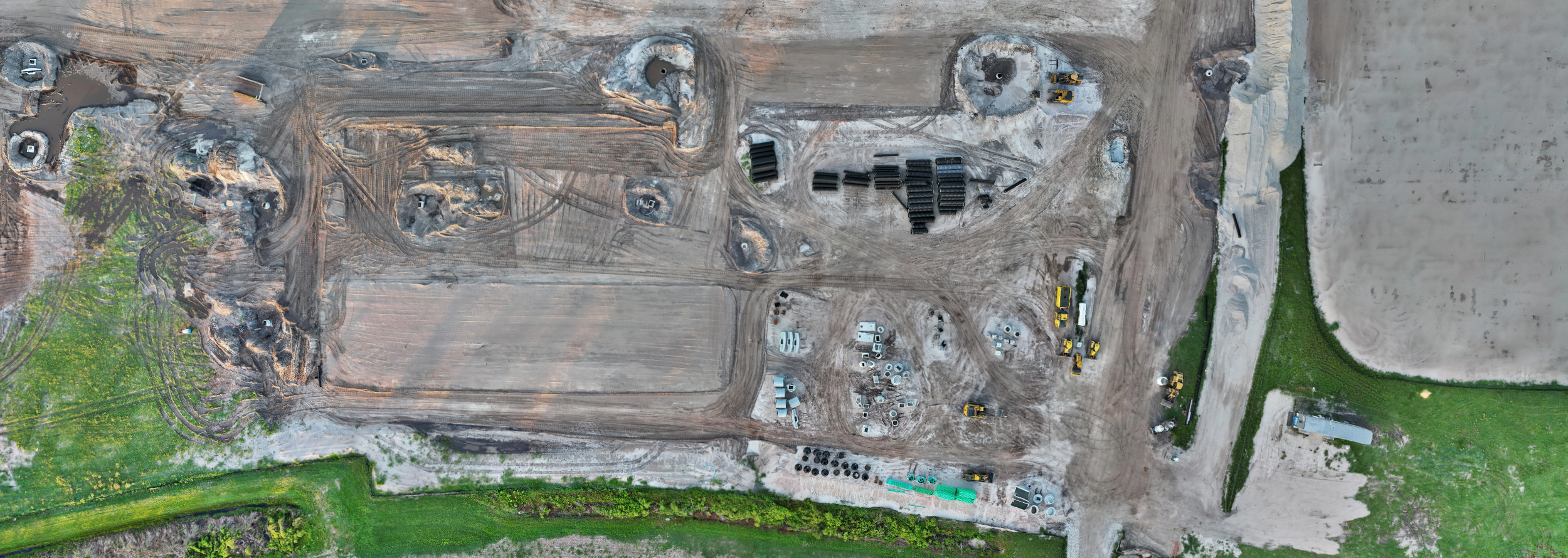
Aerial view of a construction staging site captured by RARI Drones, showing the level of detail weekly drone mapping provides to project managers, GC’s, and developers.
The Job Site Is Changing Every Day. Your Documentation Should Too.
A construction site doesn't sit still. Earthwork gets moved, concrete gets poured, steel goes vertical, and somewhere between the first grading pass and the final punch list, things happen. Whether it be delays, disputes, weather events, or change orders, that costs real money when there's no documentation to back up what actually occurred.
That's why general contractors and developers across Tampa Bay and nationwide are adding weekly drone mapping to their project workflows. Not as a luxury, but as a standard operating procedure.
A Single Flight Gives You a Snapshot. Weekly Flights Give You a Timeline.
If you've ever had a drone flown over your site, you know the images are impressive. But a one-time flight only tells you what the site looked like on that one day. Weekly flights change the game entirely. They build a visual timeline of your entire project, from first dirt to final inspection.
Every week becomes a chapter in your site’s story. And when you need to go back to answer a question: “When was that slab poured?” “Was the east pad graded before or after the storm?” You don't rely on memory or search through hundreds or thousands of images trying to recall. You pull up that week's data and instantly see it for yourself.
What Weekly Mapping Actually Solves.
Not familiar with the mapping deliverables we're talking about? Orthomosaics, 3D models, elevation data? Read our breakdown of what a 2D orthomosaic is and what you actually receive → https://www.raridrones.com/insights/what-is-a-2d-orthomosaic
Dispute Resolution With Evidence, Not Arguments.
A subcontractor says they were on schedule, but the timeline says otherwise. Weekly maps create an indisputable visual record that holds up when conversations get difficult. No interpretation needed as the data speaks for itself.
Stakeholder Updates Without the Site Visit.
Investors, lenders, and ownership groups want to see progress. Instead of coordinating site visits, scheduling walkthroughs, and hoping the weather cooperates, you can send them an interactive map link. They can see the entire site from their phone or their office. Professional, efficient, and always current.
Safety and Compliance Documentation.
When it comes to OSHA compliance, stormwater management, erosion control, or even perimeter fencing, weekly aerials capture it all. If a safety question comes up six months from now, you've got the visual record to prove what was in place and when.
Earthwork and Grading Verification.
Is the site graded to spec? Where's the fill short? Where's the drainage pooling? Elevation data from weekly flights shows exactly what's happening across the entire parcel, not just the section the surveyor walked.
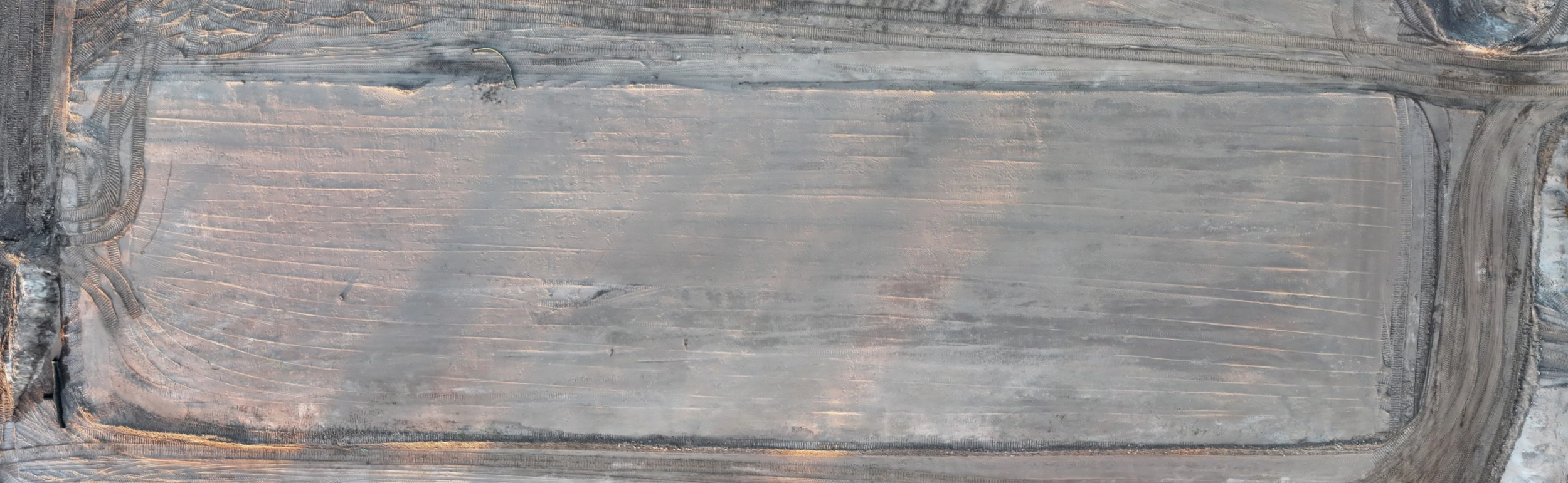
Drone-captured aerial view of earthwork and grading progress. Weekly mapping tracks elevation changes and compaction across the entire site.
Weather Event Documentation.
Florida is beautiful, but we get hit and builds are no different. Whether it be hurricanes, tropical storms, or just heavy rain events, they can set a project back weeks. A drone flight immediately after a weather event captures the damage, the standing water, and the displaced materials. When compared to the previous flight and map before the event, that documentation supports insurance claims and schedule adjustments with real evidence.
How It Works.
The process is designed to be simple and stay out of your crew's way:
Schedule: We establish a recurring flight day that works with your site’s operations. Early morning flights before crews arrive are ideal so there is zero disruption to your workflow.
Fly: A single flight mission covers the entire site in 15–30 minutes depending on acreage. RTK-enabled GPS provides sub-centimeter positioning accuracy on every image.
Process: Images are processed into your full deliverable package.
Deliver: Everything is returned within 48 hours. Shareable links, downloadable files, and organized folders. Whatever format works best for your team.
Repeat: Every flight follows the same plan, on the same schedule, giving you consistent data you can compare week over week for the life of the project.
What Does It Cost?
Less than most people think. A weekly drone mapping retainer typically costs less than a single day of conventional survey work, and delivers a broader dataset every single week.
For most general contractors and developers, the question isn't whether drone mapping fits the budget. It's how much the lack of documentation has already cost them in disputes, rework, and miscommunication.
Built for Florida Construction.
Tampa Bay's construction market moves fast. Between the growth in Pasco, Hillsborough, Pinellas, Hernando, and Manatee counties, there's no shortage of active sites, and no shortage of projects where better documentation would have saved time, money, and headaches.
RARI Drones operates primarily in the Tampa Bay region. We know the airspace, the weather patterns, and the pace of construction in this market. Every flight is conducted by an FAA Part 107 licensed pilot with RTK precision GPS and commercial-grade equipment.
The Bottom Line.
Weekly drone mapping isn't about having cool aerial photos of your job site. It's about building an airtight visual record that protects your project, informs your team, and gives every stakeholder the clarity they need, every single week.
One flight. Full coverage. 48-hour turnaround. No disruption to your crew.
Ready to see what weekly mapping looks like on your site? Request a free consultation below, and we’ll even map your site as a demo so you can see the data firsthand.