What Is a 2D Orthomosaic? The Aerial Map Changing How Construction Sites Are Documented.
The Short Version
A 2D orthomosaic is a highly detailed, geometrically corrected aerial map built from hundreds, sometimes thousands, of individual drone images. Unlike a single photograph taken from the sky, an orthomosaic is stitched together, corrected for distortion, and scaled to real-world measurements. Every pixel is accurate. Every measurement is reliable.
Think of it as a blueprint-quality aerial photograph of your entire site. One image, fully measurable, updated as often as you need it.
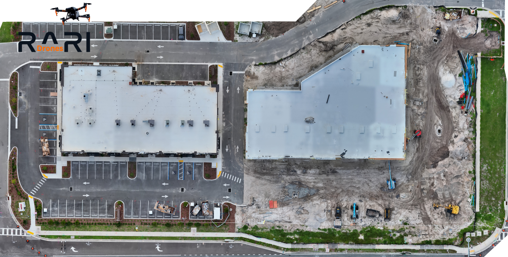
2D Orthomosaic of a construction site in Wesley Chapel, FL generated from drone imagery by RARI Drones.
How It's Made
Building an orthomosaic isn't as simple as flying a drone over a site and snapping a photo. It's a structured process:
Flight Planning: Before the drone ever leaves the ground, the pilot programs a precise grid pattern over the site using professional mapping software. The flight plan controls altitude, speed, overlap between images, and camera angle; all optimized for accuracy.
Image Capture: The drone flies the programmed mission autonomously, capturing overlapping images across the entire site. A typical 10-acre site can generate 400 to 800+ images in a single flight. Each image is geotagged with GPS coordinates, and when RTK (Real-Time Kinematic) positioning is used, that accuracy reaches sub-centimeter levels.
Processing: Specialized photogrammetry software analyzes every image, identifies common features between overlapping photos, and stitches them into a single, seamless map. During this process, the software corrects for lens distortion, terrain elevation changes, and camera angle variations, producing a geometrically accurate, orthorectified image.
The result: One massive, high-resolution aerial map where distances, areas, and features can be measured directly. No guesswork. No estimation.
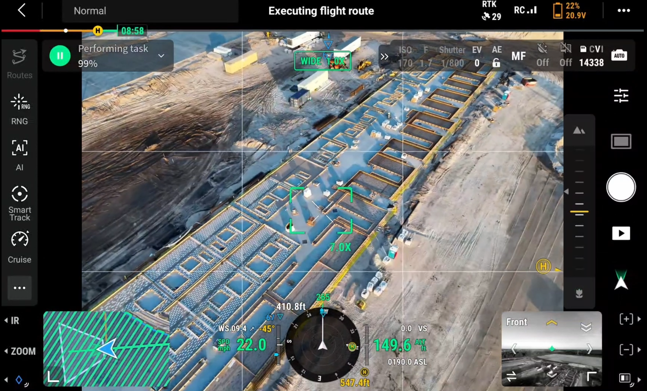
DJI drone controller screen showing automated mapping flight plan over a 71-acre construction site in Tampa Bay, FL.
Why It Matters for Construction
A single drone photo looks impressive. An orthomosaic is actually useful. Here's the difference:
Accurate Measurements: Need to measure a building footprint, a cleared area, or the distance between two points on site? Measure directly on the orthomosaic. The measurements are real.
Progress Documentation: Fly the same mission weekly, and you build a timeline of your project from start to finish. Compare this week's map to last week's and see exactly what changed. What was poured, what was graded, what was erected. Every phase, documented.
Stakeholder Communication: Send a superintendent, project manager, or investor a single link to an interactive map they can zoom, pan, and explore from their desk. No site visit required to see exactly where things stand.
Dispute Resolution: When questions come up about timelines, site conditions, or work completed, a dated orthomosaic is documented evidence. Not someone's memory of how the site looked.
GeoTIFF Export: Orthomosaics can be exported as GeoTIFFs, georeferenced image files that drop directly into CAD, GIS, and project management platforms with full coordinate accuracy. Your engineers and surveyors can overlay the aerial map on site plans immediately.
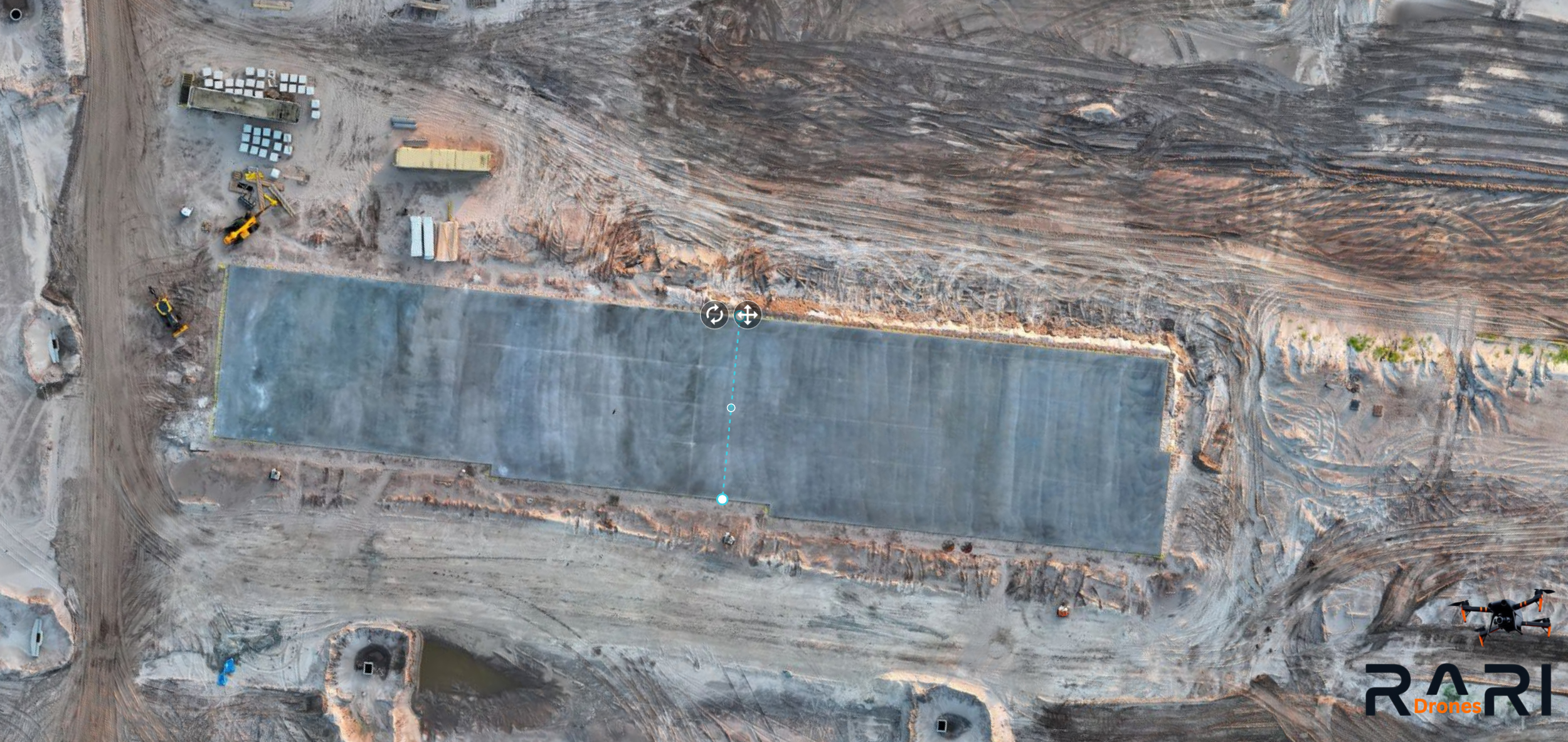
DroneDeploy measurement tool demonstrating distance measurement capability on a 2D orthomosaic.
What You Actually Get
When RARI Drones delivers a 2D orthomosaic, you're not just getting one file. A typical deliverable package includes:
High-resolution orthomosaic: the full aerial map.
Interactive map link: shareable, zoomable, accessible from any browser.
GeoTIFF: georeferenced file for CAD/GIS integration.
Digital Surface Model (DSM): elevation data across the entire site.
KMZ file: overlay in Google Earth.
Detail shots: close-up images of specific areas of interest.
Everything is processed, organized, and delivered within 48 hours.
How It Compares
How does an orthomosaic compare to a standard drone photo?
Single Drone Photo:
Not measurable
Not geometrically accurate
Partial site coverage
Inconsistent framing between flights
Can't export to CAD or GIS
No interactive sharing
2D Orthomosaic:
Fully measurable
Geometrically accurate
Complete site coverage
Exact same mission repeatable every time
Exportable to CAD/GIS as a GeoTIFF
Shareable interactive map link
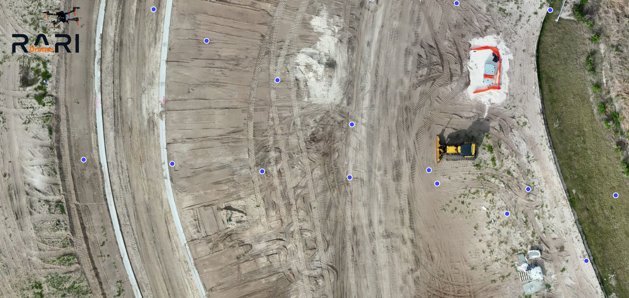
DroneDeploy 2D orthomosaic with image capture points, showing individual drone photos used to build the aerial map.
Who Uses Orthomosaics?
General Contractors: Weekly progress documentation, owner updates, pre-construction baselines.
Project Managers: Remote site monitoring, coordination between trades.
Developers: Investor updates, marketing materials, due diligence documentation.
Civil Engineers: Site plan overlays, grading verification, as-built comparisons.
Insurance & Legal: Date-stamped documentation for claims and disputes.
The Bottom Line
An orthomosaic turns a construction site into a measurable, shareable, documented asset. It's not a photo, it's data. And when you fly it weekly, it becomes a complete visual record of your project from dirt to done.
RARI Drones
Professional drone mapping and inspection services throughout the Tampa Bay area.
📞 877-606-RARI
🌐 www.raridrones.com
FAA Part 107 Licensed | RTK-Enabled for Sub-Centimeter Accuracy